The Wilder School’s Geographic Information Systems program leads students into the geospatial future
When cities plan for rising sea levels or companies search for the best location to open a new store, one tool helps make sense of it all: Geographic Information Systems or GIS.
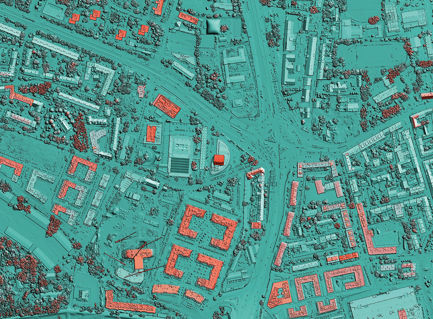
GIS is a mapping technology that manages, analyzes, and visualizes geospatial data in both vector and raster formats. GIS provides innovative solutions across industries, including urban planning. A single GIS project might be useful for land use, transportation, housing, and economic development.
At the L. Douglas Wilder School of Government and Public Affairs, graduate students in urban and regional studies and planning and other disciplines can build geospatial expertise through the Graduate Certificate in Geographic Information Systems. The certificate equips students with practical skills in geospatial foundations, methodologies and applications.
Wilder School associate professor of urban and regional planning I-Shian “Ivan” Suen, Ph.D., and Mark Bittner, AICP, adjunct instructor and director of regional planning and GIS for PlanRVA, ensure that students grasp the fundamentals of GIS through hands-on training, advanced projects and real-world research applications.
“The GIS program enhances the URSP curriculum through specialized instruction in geospatial analysis and visualization. It also serves as a strategic recruitment pathway into the URP program,” said Suen.
The GIS program stands out among other universities’ geospatial offerings for welcoming both traditional and nontraditional students from many unique disciplines. A student from other majors can benefit as much as an urban planning student. GIS can be used for site evaluation or 3D visualization in urban planning, while it can help a business owner pinpoint the most profitable location for a new store.
“Because of the multidisciplinary nature of GIS technology and its wide range of applications, our program is ideally housed in the Wilder School of Government and Public Affairs,” Suen said. “It strengthens collaboration and interdisciplinary work among programs across the school.”
Students in the GIS Certificate Program complete two required courses and two electives:
Required Course:
- URSP 521 OR 621 Introduction to Geographic Information Systems
- URSP 622: Community Socioeconomic Analysis Using GIS
Elective Courses:
- URSP 523: GIS for Land Use and Transportation Planning
- URSP 625: Spatial Database Management and GIS Modeling
- URSP 629: Quantitative Geospatial Data Analysis
>>Learn more and apply to the Wilder School
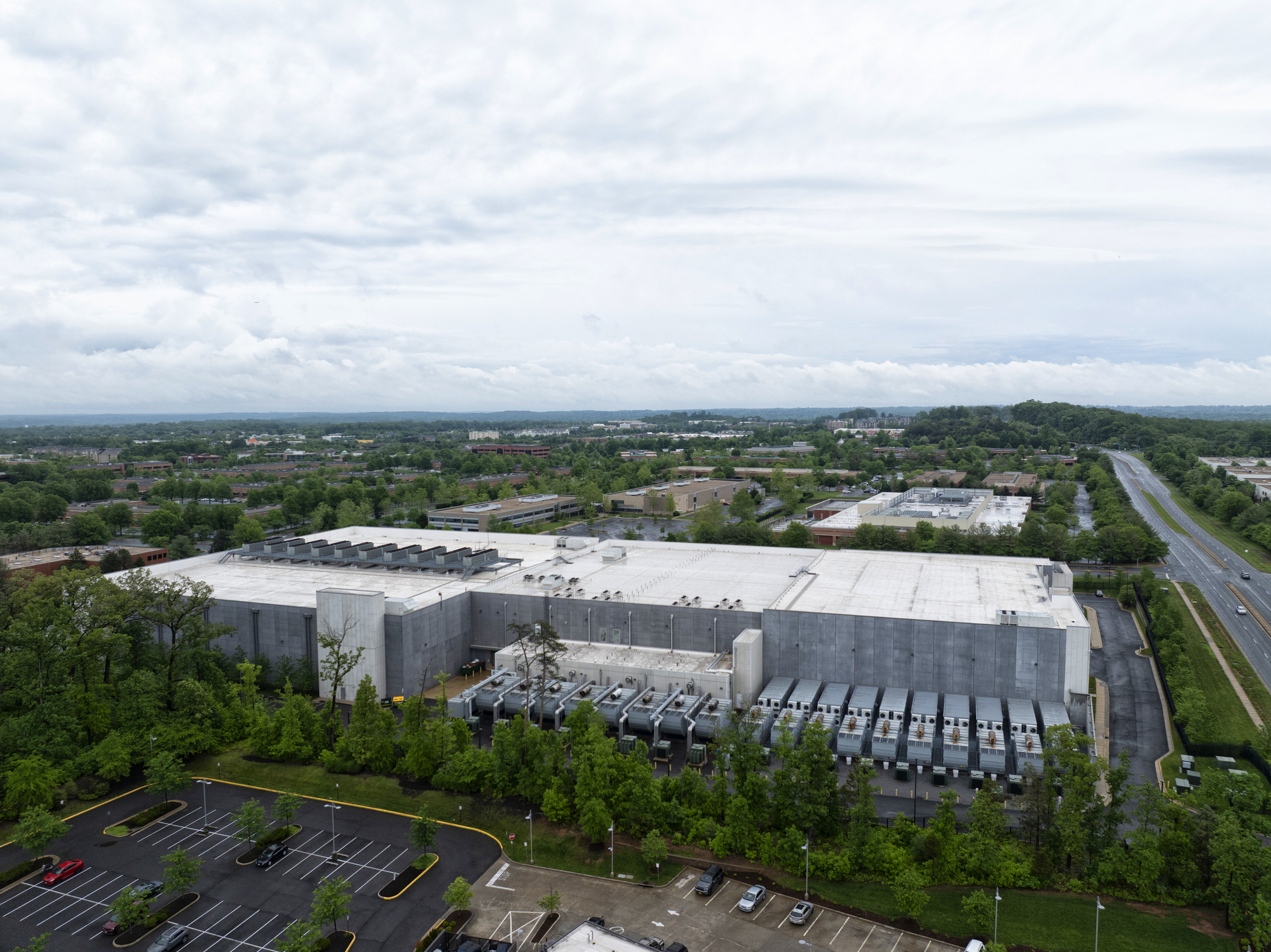
In addition to coursework, students apply their skills through research projects. Currently, participants are studying the air-pollution impacts of data centers on local communities, analyzing permitted emissions from backup natural-gas and diesel generators.
Suen hopes that the program’s expansion will continue as GIS tools become increasingly accessible to the public.
“This is going to be a very promising area,” he said. “The program gives students practical skills that make them competitive in the job market.”